Contents
Index
Extended Attributes
The GeoCadastre Config file allows additional attributes to be applied to Plans, Parcels, Parcel Lines and Control Points.
The generic GeoCadastreConfig.xml file is located in the install directory.
If the defaults were used this will be C:/Program Files (x86)/Geodata).
Extended Attributes have no impact on the program or the adjustment engine. They are simply stored as additional information.
Geocadastre Config File
The config file is in XML format and it may be edited with a text editor.
Structure of this file is complex and it is preferable that Geodata be asked to customise this file.
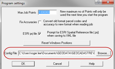
Selecting the Config File
The config file can be specified in the Program Settings.
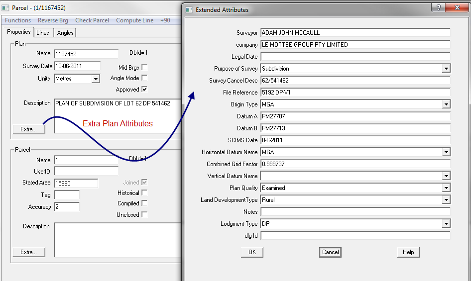
Plan Properties
Additional information can be added to each plan and stored as extra attributes.
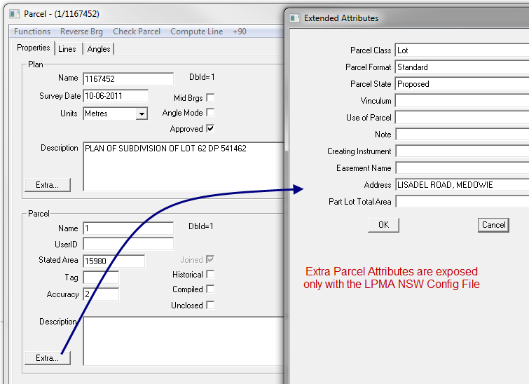
Parcel Properties
Additional information can be added to each parcel and stored as extra attributes.
Parcel Lines Grid
The parcel lines grid can be extended to add extra attributes to each line.
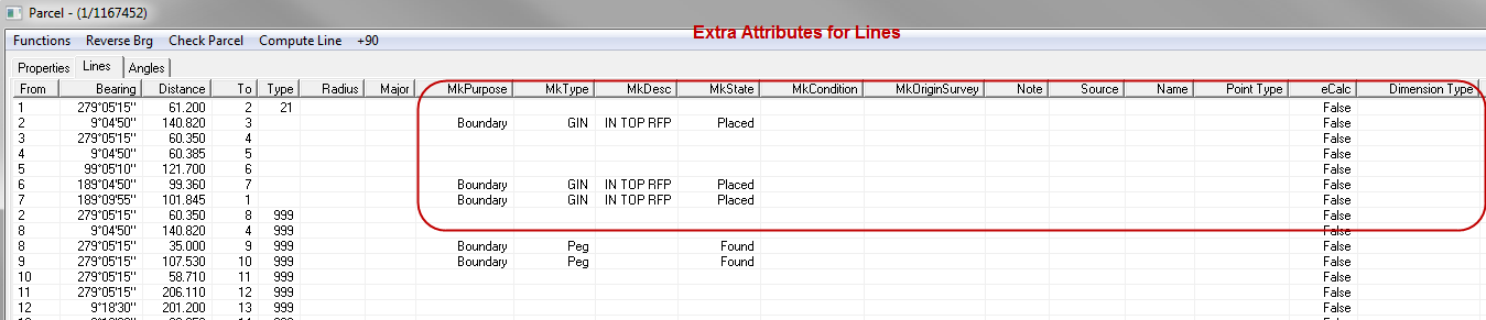
The attributes added to the basic grid in this instance are:
MkPurpose, MkType, MkState, MkOriginSurvey, MkDesc, MkCondition, Note, Source, Name.
These attributes can be edited and the columns can be expanded as required.
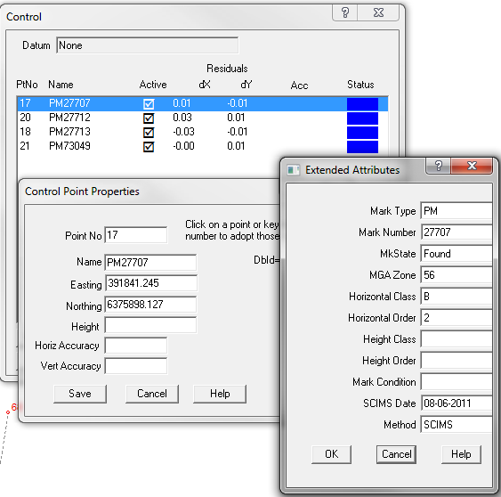
Control Points
When extra attributes are added for control points, they will be in an additional dialogue box which appears
after the changes in the first dialogue box have been accepted.
Sticky Parameters
When extended attributes for a Plan are inserted the parameters will be repeated by the program for insertion
into the Plan Properties for all parcels in the plan.